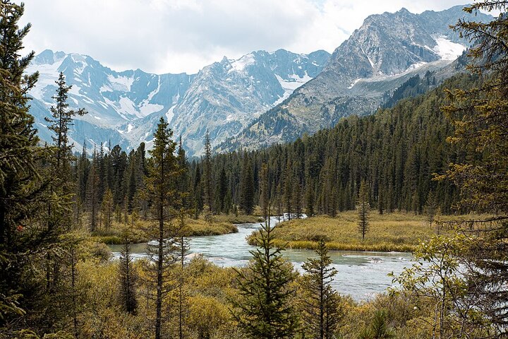
A mountain river in the heart of the Altai Mountains. Photo: Sapsan481 / Wikimedia Commons, CC BY-SA 4.0
Altai promises much: snow-capped peaks, steppes with glaciers on the horizon, caves, waterfalls, and red clays reminiscent of Mars. All of this exists, but it's scattered across an area half the size of France, and the first trip easily turns into an endless road with only two or three stops. It's worth choosing Altai's attractions in advance, before your trip.
It's smarter to start with geography. There are two Altai regions: the Altai Republic, with its capital in Gorno-Altaisk, and the Altai Krai, with its center in Barnaul. People go to the republic for mountains, passes, and beautiful views. Resorts, caves, and steppe lakes are located in the region. It's a five-hour drive between Barnaul and Gorno-Altaisk, so it makes sense to plan your route within the same region—otherwise, half your vacation will be spent on the road.
| Altai Republic | Altai Krai | |
| Administrative center | Gorno-Altaysk | Barnaul |
| Natural objects | Chuysky Tract, Lake Teletskoye, Belukha, Ukok Plateau, Karakol Lakes | Denisova Cave, Belokurikha, Lake Kolyvanskoye, Tigirek Nature Reserve |
| Infrastructure | 5* resorts, signature glamping sites, and ethno-hotels along the route | Sanatoriums, resort hotels, smooth roads |
| Target audience | Trekkers, car travelers, photographers | Families, spa and wellness enthusiasts |
| Route difficulty | Medium and high, part by SUV | Low and medium, a passenger car is enough |
National Parks and UNESCO Natural Sites in Altai
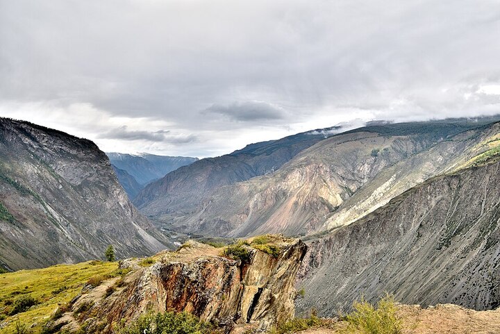
Altai Nature Reserve: Turochak and Ulagansky Districts, Altai. Photo: Alexander Baidukov / Wikimedia Commons, CC BY-SA 4.0
Part of the Altai Mountains is protected at the international level - Under the name "Golden Mountains of Altai" they were added to the UNESCO World Heritage List in 1998Approximately 1.64 million hectares were protected, divided into three areas: the Altai Nature Reserve with a buffer zone around Lake Teletskoye, the Katunsky Nature Reserve—one of the largest mountain reserves in Russia—along with the Belukha Nature Park, and the Ukok Quiet Zone.
The special status of these territories dictates its own rules. Access to the nature reserves requires a permit, and pitching tents and lighting fires is permitted only at designated campsites. Some routes are completely inaccessible without a guide. Strict restrictions apply to Lake Teletskoye's eastern shore—this is part of the Altai Nature Reserve, where boats can only dock at cordons, and disembarking in the wild taiga is not possible (unlike the open western shore). A permit to visit the reserve must be obtained in advance, and a strict "quiet zone" is in effect on the Ukok Plateau: leaving the paved road is strictly prohibited.
The protected status explains why some of the Altai Mountains' attractions remain sparsely populated even in August: the flow is regulated by quotas and permits. This is a plus for travelers—the trails are untrodden, there's little litter, and the animals come close to the road. There's one downside: a spontaneous visit to a lake or an overnight stay on a favorite shore within the protected area will result in a fine.
The Altai Republic's main attractions: what to see first
The republic fits into a single route if you stick to the Chuysky Highway. The road leads south from Gorno-Altaisk, and the landscape outside the window changes every couple of hours: first, the cedar taiga on the Seminsky Pass, then the serpentine road to Chike-Taman, then the steppe with the glaciers of the North Chuysky Range on the horizon and the red clays of Kyzyl-Chin near the Mongolian border. Offshoots from the highway lead to Lake Teletskoye, the Karakol Lakes, and the foot of Belukha—each worth a separate day.
Seven things you should see first:
- The Chuysky Tract is one of the most beautiful roads in the world according to National Geographic.
- Lake Teletskoye is a UNESCO site with a depth of up to 325 meters.
- Mount Belukha is the highest point in Siberia on the border with Kazakhstan.
- Akkem Lake at the foot of Belukha is the goal of a classic trekking trip.
- The Katun Valley and the Multinsky Lakes are water routes of varying difficulty levels.
- The Ukok Plateau is a high-mountain steppe at the junction of four states.
- Petroglyphs of Kalbak-Tash - 3700+ rock carvings right next to the tract.
The Chuysky Tract is one of the most beautiful roads in the world.
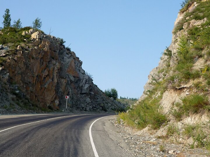
A road through the rocks at the Chike-Taman Pass. Photo: Demin Alexey Barnaul / Wikimedia Commons, CC BY-SA 4.0
In 2014, National Geographic put The Chuysky Trakt ranks fifth among the most beautiful roads on the planet—the only Russian highway on that list. The road runs from Novosibirsk to the Mongolian border, and its tourist section begins south of Gorno-Altaysk: the asphalt is good, the road markings are fresh, and the gas stations become less frequent as you gain altitude.
There are five iconic places along the route that are definitely not worth missing:
- the confluence of the Chuya and Katun at the 712th kilometer: the two rivers flow side by side in different colors, gray-steel and greenish;
- Chike-Taman pass, about 1295 meters high: a serpentine road with an observation deck and shopping arcades at the top;
- Kurai steppe: a flat bowl, behind which rises the North Chuisky ridge with glaciers;
- the Kyzyl-Chin tract, known as Mars: layered clays of red, yellow and green shades;
- Aktash village and the repeater above it: a viewpoint at 3000 meters with a dirt climb.
The best time to travel the highway is from mid-June to late September: during this time, it's dry and all the passes are open. A standard passenger car will suffice on the paved road, but only a high-clearance vehicle will be able to reach Kyzyl-Chin and the Aktash repeater. It's best to fill up in Ongudai or Aktash; further gas stations are scarce, and the necessary fuel may not be available. Download offline maps in advance, as there is no service on the passes and in the Kurai Steppe. It's best to complete the daytime drive before dusk: there are no lights on the highway, and animals regularly wander onto the road.
Kyzyl-Chin lies seven kilometers from the highway, along a dirt road running alongside a stream. The clay layers change color depending on the light: ocher predominates in the morning, while by sunset the slopes turn red. Walking along the ridges is prohibited—the rock crumbles underfoot. From Aktash, a rough road leads up to a repeater station at an altitude of about 3,000 meters: the climb takes an hour, and from the top, the entire North Chuya Range opens up.
Lake Teletskoye is the pearl of the Altai Mountains.
The lake stretches for 78 kilometers, reaches a depth of up to 325 meters, and covers an area of 223 square kilometers. It's the second-largest lake in Siberia after Lake Baikal in terms of pure fresh water reserves (nationally, it's second only to Lake Ladoga and Lake Onega). The northern shore is populated: the village of Artybash, docks, cafes, and boat rentals. The southern shore remains wild; there are no roads, and it takes several hours to reach by boat.
The boat travels along the starboard side to the Korbu Waterfall—a twelve-meter drop, a wooden deck, a railing, and rows of souvenir shops. In July, there's a line at the deck, but by evening the crowd thins out. In autumn, the scene changes: the larch trees turn yellow, the water darkens, and pleasure boats are less frequent, but the banks are visible through and through.
Besides Korbu, you can take a boat to the Kishte and Estyube waterfalls, explore Kamenny Bay, or reach Cape Kyrsai at the southernmost point of the lake. A longer boat trip will take about eight to nine hours, while a shorter one takes three. It's best to buy tickets early in the morning right at the pier in Artybash, as daytime trips are often fully booked. Few people dare to swim in the lake: even in August, the water near the shore warms up to a maximum of 18°C, while in the deeper water it remains bracing, at around 10°C. If you do decide to take a dip, it's best to choose the shallows in Artybash or Iogach, where the water is warmer.
Artybash is open year-round: in winter, people come here for ice fishing and the empty shores. The road from Gorno-Altaisk to the village takes about three hours on asphalt, with the last kilometers running along the Biya River.
ADVICE. The weather on Teletskoye can change dramatically in an hour: a southerly wind blows in, causing waves up to a meter high. Go boating in the morning, while the lake is calm, and bring a windbreaker even in the July heat—it's noticeably colder on the water than on the shore.
Mount Belukha is the highest point in Siberia.
By data According to encyclopedias, Belukha is 4,509 meters high. The summit lies on the border with Kazakhstan, and climbing it requires mountaineering training, equipment, and a group with an instructor. The trek to Lake Akkem at the foot of the mountain is suitable for regular tourists in reasonable physical condition: from the village of Tyungur, it's a two- to three-day hike or a transfer by all-terrain vehicle.
The Altai people consider the mountain sacred, and local noise and littering bans are in effect at the foot of the mountain—they must be observed. Lake Akkem lies in the border zone: in the summer, a guard is stationed there, passports are checked, and without them, you won't be allowed onto the Akkem Glacier. Day trips depart from the lake: to the Yarlu Valley with its red clay slopes and to the Seven Lakes on the terraces above the glacier. Many people set aside an extra day for these hikes. The best time to hike is from mid-July to early September: earlier, there's still snow on the Kara-Tyurek Pass, and the fords across Lake Akkem are higher than the knee.
IMPORTANT. A border pass is a permit for staying at the state border. According to border regulations, Russian citizens only need a passport within the border zone, and a separate pass is required for a five-kilometer strip along the border. Foreigners require a pass for the entire zone. Applications must be submitted in advance to the FSB Border Directorate for the Altai Republic.
The Katun River Valley and the Seminsky Pass
Anyone who's ever leafed through photos of Altai knows about the turquoise Katun. The problem is, you almost never see it like this in the summer. From May to July, the river carries meltwater from the glaciers, the glacial sediment turbidifies the flow, and instead of turquoise, you get a steel-gray ribbon. By September, the glaciers stop melting. nutrition switches to groundwaterThe sediment settles, revealing a greenstone sandstone bottom through the transparent layer. This same color persists throughout the fall and winter, in ice-free stretches of water.
The Katun River is closest to civilization in the Chemalsky District: tourist centers line up one after another, rafting stations gather groups every morning, and a couple of hours' rafting is manageable for a beginner. It's a day's drive from the airport by car, and this section of the Altai Mountains is the most densely populated. Upstream, in the Ust-Koksinsky District, the story is quite different: the Multinsky Lakes cascade, their banks littered with kurum, and people get there in UAZ vehicles. The water is icy year-round, but in August, you might not see anyone on the shore.
The two passes on the highway look different. Seminsky climbs to 1,717 meters, but it gains altitude gradually: at the top is a stele commemorating the incorporation of Altai into Russia, a cedar forest, and meadows where edelweiss blooms in June. Chike-Taman is almost four hundred meters lower, but it cuts the slope with a steep switchback, and from the observation deck, the old road below is visible. Both are best traveled in the morning: the sun is at your back, and the tourist buses arrive around midday.
INTERESTING FACT. The Chuysky Highway stretches almost a thousand kilometers from Novosibirsk to the Mongolian border. The tourist section begins beyond Gorno-Altaisk: from there to Kosh-Agach, it's about 470 kilometers, which takes two days to cover, including stops.
Ukok Plateau, Karakol Lakes and Kalbak-Tash Petroglyphs
The Ukok Plateau lies at the junction of the borders of Russia, Kazakhstan, Mongolia, and China, at an altitude of over two kilometers. In 1993, archaeologists found The mummy of a woman from the Pazyryk culture, known as the Princess of Ukok, was found here. Since 2012, it has been kept in the Anokhin National Museum in Gorno-Altaisk. The road to the plateau is unpaved and fordable; a prepared SUV is required, and foreigners also need a permit. The route is challenging for a first trip. The warm season on the plateau is short: the snow melts in June and returns in September, and nighttime temperatures drop below freezing even in July.
The Karakol Lakes are simpler: seven bodies of water at varying elevations, each with its own unique color due to its depth and soil. The ascent takes a day, with an overnight stay at a tourist camp near the lower lake, and the descent to the next. The optimal time is early September, when the midges have disappeared and the trail has dried. By this time, the upper lakes already reflect the snow on their ridges. The ascent is along a difficult dirt road, suitable only for all-terrain vehicles. Therefore, people usually leave their car in Elekmonar and drive a GAZ-66.
The Kalbak-Tash petroglyphs stand right next to the highway, at kilometer 723, seventeen kilometers beyond the village of Inya. More than 3,700 images have been counted on the rock outcrops—from Neolithic deer to Turkic horsemen and runic inscriptions. It's worth planning about an hour to explore the petroglyphs. It's best to explore them with a guide: without a trained eye, the carvings simply blend into the stone surface. And just nearby, at kilometer 730, are stone sculptures and ancient burial enclosures—they're located right next to the road, so you won't have to walk far.
Altai Krai attractions and seasonal travel tips
The region offers a different kind of travel experience: instead of mountain passes, there are sanatoriums, caves, and lakes in the foothills. The roads here are smoother, the distances are shorter, and there are noticeably fewer tourists than on the highway.
The main attractions of the region: Belokurikha, Denisova Cave, Kolyvan Lake
Belokurikha is located in the foothills at an altitude of approximately 250 meters. The resort uses nitrogen-siliceous, weakly radon thermal waters with temperatures ranging from 30–42°C. Soviet-era sanatoriums stand side by side with newer buildings, and the cable car to Mount Tserkovka is nearby. Higher up the slope, the Belokurikha-2 cluster is being developed. Health paths are marked along the slope, and the ascent to Tserkovka takes twenty minutes by chairlift. Trails are open in winter, and in the warm season, routes lead to outlier rocks with beautiful views of the foothills.
Denisova Cave in the Soloneshensky District rewrote ancient history textbooks. In 2010, geneticists determined DNA from a previously unknown population of ancient humans, dubbed the Denisovans, was identified from a finger phalanx found two years earlier. It turned out that three branches of humanity coexisted in Siberia: sapiens, Neanderthals, and Denisovans. A museum exhibition is located at the cave, with opening hours varying seasonally. The cave is located on the bank of the Anui River, with the entrance visible from the road. Excavations are ongoing inside, and some rooms are closed to the public.
Lake Kolyvan is surrounded by granite outliers carved by the wind into the shapes of mushrooms and towers. Chilim, a water chestnut, grows in the water: a relic of the pre-glacial period. listed in the Red Book, and collecting it is prohibited. The Tigirek Nature Reserve to the west is closed to the public; excursion routes are coordinated in advance: this format is for those seeking the pristine taiga.
When to go to Altai: seasons and their features
The season determines half the experience – from the color of the water to the number of people on the observation decks.
| Season | Daytime temperature | Pros | Cons | Who is it suitable for? |
|---|---|---|---|---|
| Spring, April – May | +10…+20 °C | Maralnik blossoms, sparsely populated viewing areas, free hotel dates | Some of the passes are still closed, the rivers are muddy | For photographers and those who want to catch the bloom |
| Summer, June – August | +20…+30 °C | All routes are open, rafting and boat services are operating | Peak season, midges in June, best rooms booked months in advance | For families with children, first trip |
| Autumn, September – October | +5…+18 °C | Transparent Katun, golden larch, empty paths | It's cold at night, some of the bases are closed | Trekking, road trips |
| Winter, November – March | -10…-25 °C | Belokurikha, skiing on the Seminsky Pass, turquoise water | Long distance routes are not available, short day | Resort recreation and alpine skiing |
Summer peak is felt in bookings: by the end of August The occupancy rate of certified hotels reaches 70%, and it's best to book locations three months in advance. Maralnik (Rhododendron ledebourii) blooms in late April, peaking in early May and lasting for about two weeks: the slopes along the road turn purple. Midges are active from mid-June to late July, most intense in valleys near water: repellent and long-sleeved clothing are essential.
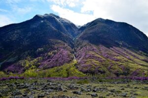
Maralnik blooms in late April and lasts for about two weeks. Photo: Wieldi / Wikimedia Commons, CC BY-SA 4.0
Where to stay in Altai
Comfort here has long since ceased with the asphalt. Along the Katun River and on the banks of Lake Teletskoye, resorts of European standard have sprung up, where after a day on the winding roads, you'll find a spa, signature cuisine, and floor-to-ceiling panoramic windows.
Grand Chalet Altay 5* Situated in the "Turquoise Katun" region, surrounded by mountains and a centuries-old pine forest, the spacious Alpine-style chalets, a spa with four types of steam rooms and a heated outdoor pool, and a restaurant with a signature menu make it equally ideal for couples and extended families.
Altay Village Teletskoe 5* It remains the only five-star resort on Lake Teletskoye. Cedar chalets are hidden in the protected taiga, the Ozero restaurant prepares game and fish from mountain rivers, and the terrace offers a view of the water that's worth staying an extra day for. A Siberian banya with Russian steam bath masters, a swimming pool, and a tennis court are also included.
Cosmos Collection Altay Resort Situated in a picturesque valley at an altitude of approximately 700 meters, it boasts its own lakes, a maral farm, a clinic and spa, and horseback riding and rock climbing are available right on the premises. It's perfect for those who want to combine exploring the mountains with recuperation.
They hold a bar nearby Clever Resort 5* and resort Manzherok 5* with a cable car to Sinyukha. And for some color, they go to "Agrocomplex Inegen" On the banks of the Katun River: comfortable houses with panoramic windows or a night in a real aul, a bathhouse, gazebos by the water, and throat singing from local performers.
A tent is pitched along the route only where the destination is otherwise unattainable: near Akkem, on the approaches to the Karakol Lakes, and in the Chulyshman Valley. This is part of the adventure, carefully planned down to the last detail: the kitchen, sleeping arrangements, and support staff remain at the same standard. Many specifically request one such night under the stars for the romance of the hike.
Communications are often lost in the Ulagansky and Kosh-Agachsky districts, in the Kurai steppe, and on the approaches to Akkem, so warn your loved ones in advance. The best rooms for July and August are booked up several months in advance, and during the off-season, some resorts close for maintenance—it's best to book your dates well in advance.
What do they bring from Altai?
People bring things from Altai that you can't buy at home: mountain honey made from wild herbs, pine nuts, herbal infusions with thyme and sagan-dailya, and sea buckthorn oil. Maral breeding farms in the Ust-Koksinsky district sell antler products, and in Chemal and Artybash, the roadsides are lined with stalls selling cedar utensils and wool socks made from camel yarn.
It's best to buy from the farms themselves in villages: the origin is clear there, and the honey and antlers are taken directly from the apiary or maral farm. Honey is tested by crystallization: real mountain honey sets solidly by October.
How to get to Altai and a practical route
Three ways to get there:
- A direct flight to Gorno-Altaysk from Moscow takes about 4.5 hours; flights are operated by Aeroflot, S7 Airlines, and Ural Airlines; the distance is 3,132 kilometers.
- Flying to Barnaul or Novosibirsk offers more schedule options, but adds 4–7 hours of travel time on the highway.
- By car from the European part of Russia - four days behind the wheel.
CAREFULLY. Taxis at the Gorno-Altaysk airport exit are highly inflated. It's best to book a transfer or rental car in advance, and ask your tourist resort administrator for the contact information of trusted drivers. And be sure to withdraw cash: bank terminals outside Aktash are rarely operational.
Itineraries for 3–5 and 7–10 days
The short program is completed in five days and is based on the following:
- Day 1. Arrival in Gorno-Altaysk, transfer to Chemalsky district, evening on Katun.
- Day 2. Seminsky Pass, Chike-Taman, stop in Ongudai or Kupchegen.
- Day 3. Kalbak-Tash, Kurai steppe with a view of the North Chuysky ridge.
- Day 4. Kyzyl-Chin tract, Geyser Lake near Aktash, return to Ongudai.
- Day 5. Road to Gorno-Altaisk, Anokhin Museum, departure.
Lake Teletskoye and Akkem don't fit into this schedule: it takes a full day each way from the highway to the lake. Both destinations require separate trips.
The ten-day option allows for a broader geographic reach, but trying to cover everything at once is a major mistake for beginners. It's logical to add two or three days on Lake Teletskoye to the Chuysky Highway, taking a boat to Korbu and then ascending to the Karakol Lakes. If Belukha is tempting, the highway trip is combined with a stop in Tyungur and a trek to Lake Akkem (or the Multinsky Lakes). It's physically impossible to cover Lake Teletskoye, Belukha, and Kosh-Agach in 10 days due to the vast distances involved. Overnight stays on a classic circular tour are usually distributed as follows: Artybash, Chemal, Ongudai, and Aktash. This allows you to see the main sites without grueling journeys.
How much does a trip to Altai cost?
The most significant expense is the flight. Direct tickets from Moscow to Gorno-Altaysk are more expensive in July and August, while prices are noticeably lower in May and September. Then there's transportation along the route: a comfortable minibus will suffice on the highway, but for the exits to Kyzyl-Chin, the Karakol Lakes, and the Chulyshman Valley, a well-equipped SUV with a driver is required.
Accommodations provide the main variety. Five-star resorts on Teletskoye and in Biryuzovaya Katun, signature glamping sites, and ethno hotels along the route vary in both service level and price, so the itinerary is tailored to specific needs. Meals along the way also vary: a home-cooked lunch with lamb and khan tea at a local family's ayil, or in the evening, a resort restaurant serving game and mountain fish.
A separate line is dedicated to activities: a boat ride on Lake Teletskoye, a helicopter flight over Belukha, rafting on the Katun River, ATV rides to Yemurlinsky Waterfall, and a guided tour at Kalbak-Tash. These activities transform the route into a personal story, and they're the easiest to schedule in advance.
What to take with you
Basic list:
- clothing in layers: thermal underwear, fleece, membrane jacket - it is cold on the passes even in July;
- trekking boots with hard soles and poles for descending the scree;
- passport, and for foreigners - a valid pass to the border zone;
- offline maps, power bank, headlamp;
- a first aid kit with painkillers, an upset stomach remedy, and fly repellent;
- Cash in rubles: ATMs are running out along with large towns.
Pay special attention to your first aid kit and water supplies: on the roads of Altai, there are stretches of up to 100 kilometers without any stores at all. It's a good idea to stock up on two liters of water per person per day, and for hiking, it's best to bring a filter or disinfectant tablets.
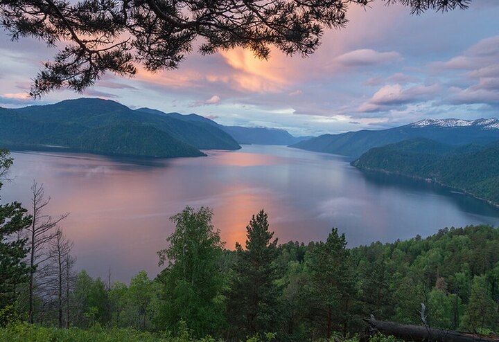
Lake Teletskoye in Altai at evening. Photo: Vanadisone / Wikimedia Commons, CC BY-SA 4.0
Summary: How to Plan a Trip
Whatever your Altai itinerary, by the end of your trip you'll almost certainly be left with a list of places you simply didn't have enough time to see. This region is worth returning to again and again for new views and experiences.
To ensure your trip goes smoothly, you need to prepare for it seriously. If you don't want to plan long journeys, arrange passes, and choose resorts yourself, we'll do it for you. individual tour of Altai From GO&DO, we'll create a route tailored to your group and your pace, plan transportation and accommodations, and handle all the necessary approvals. You'll enjoy the most valuable experience—the pure pleasure of exploring the mountains.
Frequently Asked Questions
Where is it absolutely necessary to visit in Altai?
The minimum package includes the Chuysky Highway with the Seminsky and Chike-Taman passes, the confluence of the Chuya and Katun rivers, the Kurai steppe, and the Kyzyl-Chin tract. All points are located on a single road, accessible by car, and can be completed in four to five days at a leisurely pace.
Where to go in Altai for the first time?
It's wiser to choose the Altai Republic and stick to the Chuysky Tract. The road is paved, there are accommodations every fifty kilometers, and the views change every two hours. Longer routes like the Ukok Plateau are best saved for a second trip.
What to see in Altai in 3 days?
It's possible to cover the section from Gorno-Altaisk to Ongudai in three days: the Katun Valley in the Chemalsky District, the Seminsky Pass, the Chike-Taman serpentine, and the Kalbak-Tash petroglyphs. Lake Teletskoye and Akkem don't fit into that timeframe, so it's not worth planning.
How to travel to Altai on your own?
The plan is simple: fly to Gorno-Altaysk, pick up a car at the airport, and drive along the highway, stopping at hotels and glamping sites along the way. Rooms are booked in advance, maps are downloaded offline, and cash is withdrawn in the city. An SUV is only needed for driving off-road.
What time of year is best to visit Altai?
September offers the best combination: the flow subsides after August, the trails are dry, the larch turns yellow, and the Katun River becomes clear. Summer is perfect for rafting and boating on Lake Teletskoye, late April is for the blooming of the maral grass, and winter is for Belokurikha and skiing.
Do some locations require special permits?
Yes, near the state border. Russian citizens only need a passport in the border zone; a separate permit is required for a five-kilometer strip along the border, while foreigners need one for the entire zone. Applications must be submitted to the FSB Border Directorate in advance; the exact deadlines are confirmed before your trip.
Is it worth taking children to Altai?
Yes, if you choose the quiet part of the program. Lake Teletskoye, the Katun Valley, Chemal, and Belokurikha are perfect for family vacations: short trips, resorts with children's entertainment and swimming pools, and relaxing walking routes. The trek to Lake Akkem and the climb to the Karakol Lakes are too difficult for younger children.
Sources
- "Golden Mountains of Altai" // UNESCO World Heritage Centre. — Year of inclusion: 1998. whc.unesco.org
- The Chuysky Tract was included in the top 10 most beautiful roads in the world according to National Geographic // Vesti Novosibirsk. GTRK "Novosibirsk". nsktv.ru
- Belukha (mountain) // Wikipedia, the free encyclopedia. ru.wikipedia.org
- Amitel News Agency. A river in the Altai Mountains has changed color again. Why is the turquoise Katun River turquoise? // Amitel. – September 7, 2022. amic.ru
- Seminsky Pass // Wikipedia - the free encyclopedia. ru.wikipedia.org
- Denisovan man // Wikipedia, the free encyclopedia. ru.wikipedia.org
- Chilim – the mystery of Lake Kolyvan // Ves Altai. – March 13, 2020. altlib.ru
- Around 70% of the hotel rooms in the Altai Republic are booked for the summer // TASS. Economy. tass.ru