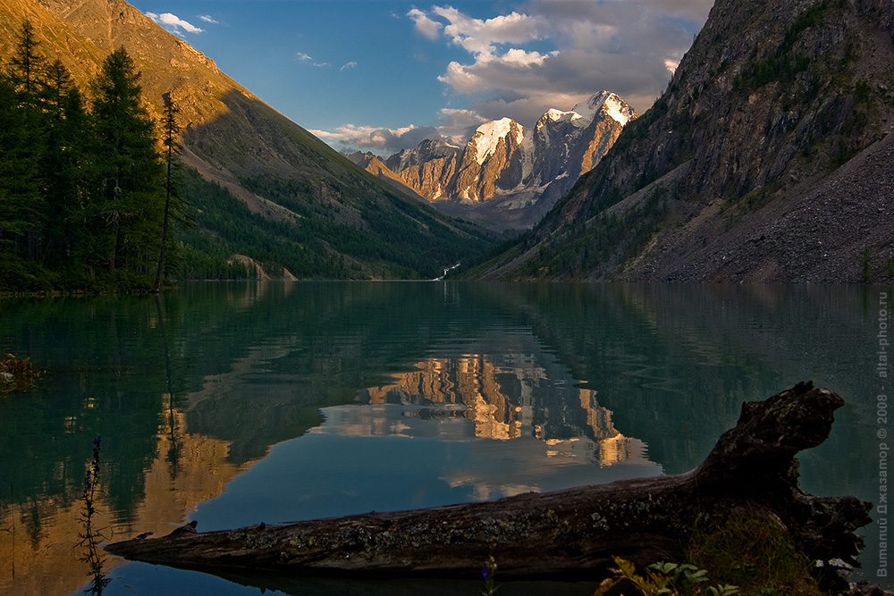
Water is found literally everywhere in Altai. It hides in deep glacial cirques beneath the mountain ranges, spills across wide valleys, and glitters as salt pans in the steppes along the border with Kazakhstan. Altai lakes number in the thousands: about seven thousand in the republic itself and over eighteen thousand — along with the neighboring region. Some bodies of water can be reached directly by road, while others require three or four days of trekking with a heavy backpack. Their color ranges from deep black to a delicate milky turquoise, and the temperature ranges from comfortable for swimming to freezing, even in the middle of August.
Briefly about the main thing
- There are about 7,000 reservoirs in the republic and over 18,000 together with the region.
- Teletskoye is part of UNESCO World Heritage List since December 5, 1998 as part of the Golden Mountains of Altai object.
- The difficulty ranges from approaching in a passenger car to four days of trekking.
- The main season lasts from June to September, with the optimal time being at the end of August.
- A pass is required to enter the nature reserves; documents for the border zone are required to enter the foot of Belukha.
Features of mountain lakes: geology, types and seasonality
The basins of most of the lakes were carved out by glaciers. As they retreated, they left behind moraine banks that blocked the valleys and trapped the meltwater. This explains the height and color: the more glacial sediment the stream carries, the deeper the water becomes, a milky turquoise. Among the republic's lakes, Lake Teletskoye, which falls within the boundaries of the Golden Mountains of Altai, has received UNESCO protection status.
According to the origin of the basins, reservoirs are divided into four groups:
- moraine-dammed and glacial in the highlands: Multinsky, Shavlinsky, Kucherlinskoye;
- karst in the northern ridges, where water has gone into limestone depressions;
- thermokarst in the south and southeast, formed during the thawing of permafrost;
- salt steppe in the neighboring region, including Bolshoe Yarovoe and Malinovoye.
Lake Teletskoye has a second name: Altyn-Köl, Golden Lake. Legend connects him with the hunter Chokul, who found a gold bar during a year of famine, carried it around to every campsite, and didn't exchange a single handful of food. He threw the bar into the water. The lake's name stuck and continues to this day.
When to go: seasonality by month
The season opens late: on the approaches to high-mountain lakes, snow remains on the passes until the end of May, and in some places until June.
| Month | Water | Paths | Flow | Recommendation |
|---|---|---|---|---|
| June | +8-+14 °C near the coast | The passes hold snow until mid-month. | Moderate | Low-mountain reservoirs and Lake Teletskoye |
| July | Maximum heating | All are open | Peak | Swimming, boats, family trips |
| August | The warming continues until the end of the month | Dry, calm fords | High, tapering towards the end | Trekking to Shavlinsky and Multinsky lakes |
| September | Cools down quickly | Open, frost at night | Short | Photography, car routes |
Late August is a favorable time for a combination of reasons: the stream thins after school holidays, the water maintains its summer warmth, and the larch trees begin to bloom. Mosquitoes and black flies plague the area from mid-June to mid-July.
The best lakes in the Altai Mountains: a rating with routes
The journey to the Altai lakes is always a choice. Some bodies of water welcome travelers right by the highway, allowing them to relax on their warm shores. Others are hidden high in the mountains, concealed behind passes and icy fords, and are accessible only to those willing to hike for several days with backpacks. We've compiled the most beautiful lakes in the region and indicated the difficulty level for each: from leisurely family outings to challenging taiga treks.
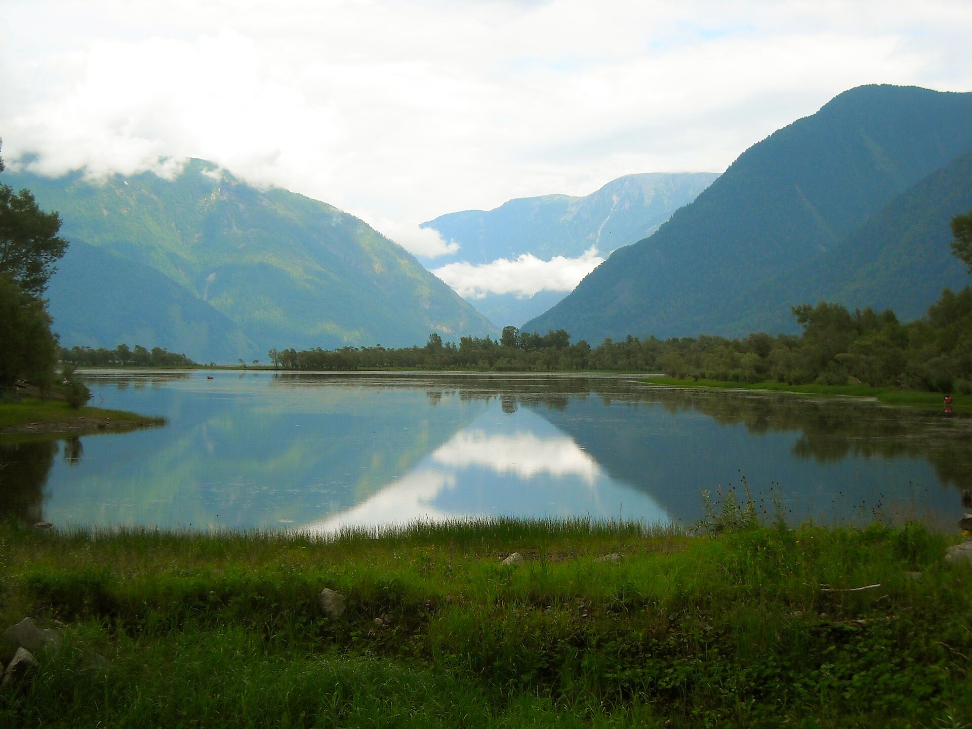
Lake Teletskoye, the "Altai Sea"
Difficulty: easy. The depth reaches 325 meters with an area of 223 square kilometers.In terms of purest fresh water reserves, this lake is second only to Baikal in Siberia. The Biya River flows out of its northern end, and the Altai Nature Reserve encloses its eastern shore.
Artybash and Iogach, located opposite each other at the source of the Biya, open the gates to the water. From there, boats depart for Korbu Waterfall: a twelve-meter drop, a wooden platform, and a railing. Depart on a morning boat; by midday, groups gather on the platform. Tours are sold right at the pier, and during the high season, watercraft also operate along the shore.
Grayling and burbot are caught at the mouths of tributaries. A permit is not required for recreational fishing, but taimen is strictly prohibited in the republic: any fish caught are released.
Multinsky Lakes
Difficulty: Medium. The cascade lies at elevations ranging from 1,627 to 2,030 meters. The Lower, Middle, and Upper cascades are connected by channels; between the first two stretches a boulder heap, which locals call "Shumy." Hidden off to the side are satellite cascades: Poperechnoye, Kuiguk, and Krepkoye.
The route starts from Multa or Ust-Koksa, and then follows a dirt road suitable for SUVs and GAZ-66s. Nizhneye and Sredneye lakes are free to visit, but Verkhneye and Poperechnoye lakes are located within the Katunsky Biosphere Reserve. To access them, you must obtain a pass in advance at the Ust-Koksa visitor center. Visiting the protected area requires a fee; please check the current rate when purchasing your ticket.
At Verkhniy Multinskoye, the water temperature remains around 6°C even in August. Early in the morning, the wind is calm, and the entire ridge is reflected until the wind picks up.
Shavlinsky Lakes
Difficulty: Difficult. Shavlinskoye Lake is surrounded by mountain peaks on three sides: Beauty, Fairytale, and Dream rise above the water. These landscapes have become the hallmark of Altai guidebooks, but the price for such a photo is the most challenging route on our list.
According to various estimates, the distance from Chibit is about 80 kilometers, with an elevation gain of over 1,500 meters. The trail crosses the Oroi Pass, followed by fords. The hike takes three days each way; mounted groups complete the route more quickly and carry the weight of their backpacks. The hiking window is short: late July and August.
Lake Manzherok (Manzherokskoye)
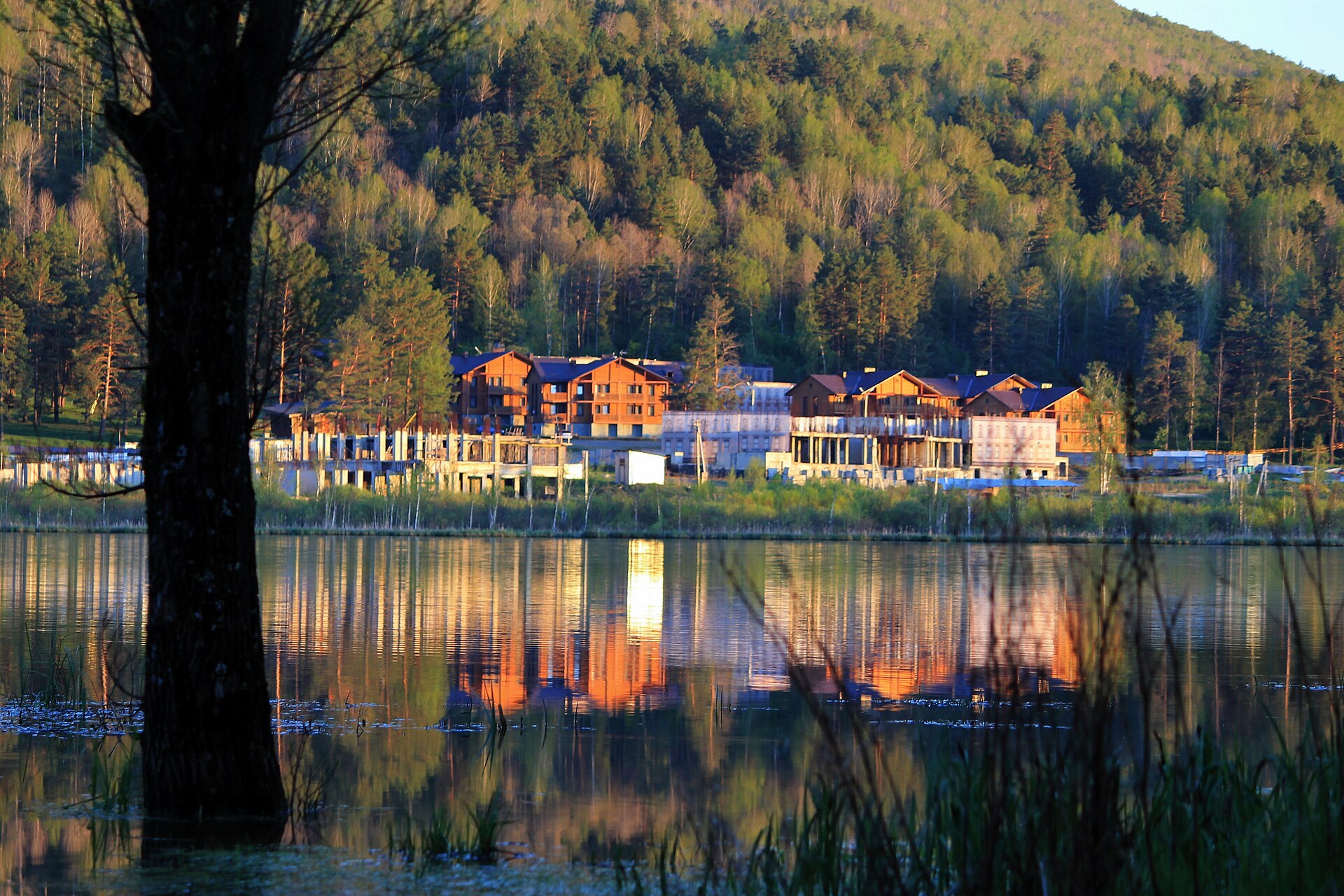
Difficulty: very easy. The lake lies low and far from glaciers, so it warms up faster than other lakes and is ideal for swimming in summer. The shore is a few minutes' drive from the Chuysky Tract. There's a resort nearby: a chairlift takes you up Mount Sinyukha, from where you can see the Katun Valley.
Don't expect any wild nature here: the surrounding area is filled with resort infrastructure, restaurants, and rental shops. This is what makes Manzherok so appealing for families with children: the journeys are short, the beach is well-equipped, and everything is within easy reach.
Akkem and Kucherlinskoye lakes
Difficulty: very difficult. Akkem lies at the foot of Belukha, The eastern peak of which rises to 4509 metersAn ice wall hangs over the water, and avalanches descend from it at night. The climbers' base camp is located here; the approach from Tyungur takes three days.
Kucherlinskoye's milky turquoise color comes from sediment carried by the Kucherla River. It's two days' drive from Tyungur. The two bodies of water are connected by the Kara-Tyurek Pass, and prepared groups can traverse them in a single loop, saving days on transportation.
IMPORTANT. Lake Akkem is a border area. Russian citizens only need a passport to enter the area; a permit is required only at the border (within 5 km). Foreign citizens require a permit for the entire border zone. The regional FSB office issues the permits—apply in advance and check the issuance timeline before your trip.
Salt lakes of the Altai Territory
Difficulty: very easy. Bolshoe Yarovoe is located in the Kulunda steppe, the salt concentration in it reaches 110–120 grams per literThe dense water keeps the body afloat, making swimming noticeably easier in this lake. Another gem of the steppe region is Malinovoye Lake, located further south, whose pink hue is due to microalgae.
There are no mountains around: the steppe is flat, the shores are open, and there's little shade. The drive from Barnaul takes about three hours, making this area accessible to families with children, older travelers, and people with limited mobility.
Practice: How to get there, where to stay, and what to pack
The range of formats here is enormous: one shore can be accessed straight from the plane, while another requires a several-day hike with a backpack. The lake you choose determines everything else—transportation, accommodation, equipment, and travel time.
Logistics: transport, accommodation and supplies
The closest airport to the water is Gorno-Altaysk Airport: a direct flight from Moscow takes about an hour to the first bodies of water. Barnaul and Novosibirsk offer more schedule options, but add several hours of highway transfer time. The Chuysky Tract, a 953-kilometer-long federal road, P256, begins in the city, with exits for all routes.
The asphalt ends along with the highway. The last kilometers to the Multinsky Lakes are on a rough dirt road, accessible only by specially prepared SUVs and GAZ-66s. To reach the Karakol Lakes, leave your car in Elekmonar and switch to an all-terrain vehicle. It's a good idea to download offline maps in advance, as service is lost for a long time after Ongudai.
Accommodations are arranged according to the itinerary. On the banks of the Teletskoye River, there's the Altay Village Teletskoe 5*, with cedar chalets and an overwater restaurant. Near Manzherok, there's the resort of the same name with a cable car to Sinyukha. In the Katun Valley, there's the Grand Chalet Altay 5* and the Cosmos Collection Altay Resort, with a spa and private lakes. The best rooms in July are booked out two to three months in advance, so the itinerary is put together well in advance.
Further up the trail, near Akkem and in Shavlinskiye, there are no hotels and will not be: tent camping is set up there, and that's part of the adventure. The kitchen, sleeping arrangements, and support staff remain the same, and the car is left in a guarded parking lot in Tyungur or Chibit.
Equipment and safety
For road trips, a windbreaker, comfortable shoes, and cash are sufficient. The trekking list is longer:
- boots with hard soles, broken in beforehand;
- trekking poles that help you maintain balance on fords and protect your knees on descents;
- water filter: it traps giardia and cryptosporidia, but does not work against viruses;
- first aid kit, power bank, headlamp;
- cash and issued passes.
Above 2,000 meters, the risk of altitude sickness increases: headache, nausea, shortness of breath at rest, and sleep disturbances. Climb gradually and drink plenty of water, and descend if symptoms intensify. Before a multi-day hike, register your group with the Russian Ministry of Emergency Situations.
ADVICE. The weather above the tree line can change in an hour: thunderstorms arrive without warning, hail gives way to sunshine. Unbuckle your backpack's waist belt when crossing rivers; this makes it easier to shed if the current carries you away.
Summary: Where to start
That perfect shot of mountain peaks reflected in the mirror-like water rarely comes without effort. The views at Shavlinskoye require a three-day backpacking trip, the route to Multinskiye Lake requires a long, bumpy ride over rough terrain, and Lake Teletskoye requires an early rise before the first boats leave. Three things to remember before your trip:
- Choose a route that suits your abilities: a beautiful photo on the internet often requires three days of travel with a backpack.
- Obtain passes to border zones and nature reserves in advance, several weeks before departure.
- When leaving the campsite, take your trash with you and leave nature as you found it.
If you don't want to rack your brain over transfers, passes, and choosing hotels, we'll do it for you. individual tour of Altai With GO&DO, you choose the level of difficulty: from leisurely excursions to the shore to trekking under Belukha. We'll take care of the rest (transportation, accommodation, paperwork, and support).
Frequently Asked Questions
What lakes are there in Altai?
Glacial and moraine-dammed lakes in the highlands include Multinsky, Shavlinsky, Kucherlinsky, and Akkemsky. The tectonic Teletskoye in the north of the republic is also present. The low-mountain Manzherok near the Chuysky Tract is a separate group: salt steppe reservoirs in the neighboring region, including Bolshoe Yarovoye and Malinovoye.
What is the most beautiful lake in Altai?
Shavlinskoye leads in terms of frequency of inclusion in guidebooks and on covers: turquoise water and the three peaks of the North Chuysky Range above. Kucherlinskoye wins for color, Teletskoye for scale. The criteria should be chosen based on your abilities and timeframe.
Which lake in Altai can you swim in?
Manzherok warms up more than other lakes because it's low-lying and far from glaciers. People swim near the shore at Teletskoye in July, but the water remains cool. High-mountain reservoirs stay around 6°C year-round, and swimming there is short.
What types of recreation are available at mountain lakes?
Boat rides and grayling fishing on Lake Teletskoye, trekking and photography on Lakes Multinskiye and Shavlinskiye, swimming and a cable car ride on Lake Manzherok, and salt baths and mud baths on Lake Bolshoy Yarovoye. The format is tailored to your preparation and time.
What time of year is best to visit the lakes?
Late August offers the perfect combination: the flow subsides, the water maintains its summer warmth, the trails are dry, and the midges retreat. July is suitable for swimming and boating, while September is ideal for photography and driving. The passes open by late May or June.
Sources
- Altai Republic // Wikipedia. ru.wikipedia.org
- "Golden Mountains of Altai" // UNESCO World Heritage Centre. — Year of inclusion: 1998. whc.unesco.org
- The legend about the origin of the names "Altyn-Köl" and "Teletskoye Lake" // Altai4u. altai4u.com
- Lake Teletskoye // Wikipedia. ru.wikipedia.org
- Belukha (mountain) // Wikipedia. ru.wikipedia.org
- Kalgashkina, O. "An analogue of the Dead Sea—what do you need to know about the salt lake Yarovoe in Altai?" // Vestnik Kavkaza. — June 19, 2024. vestikavkaza.ru
- Chuya tract // Wikipedia. ru.wikipedia.org