The thick smell of sulfur, the whistle of steam escaping from underground, and the hot stone beneath your boots. And below, on the coastal cliffs, the roar of sea lions cuts through the roar of the ocean. On clear days, from the southern tip of Kunashir, you can see the shores of neighboring Hokkaido. The Kuril Islands— These are 56 land masses stretching in an arc for 1,200 kilometers. From Kamchatka to Japan. Getting to this part of the Sakhalin region is challenging: fog or storms will get you there. But these challenging transport logistics play into the hands of true travelers: the wilderness here is yours alone, and on the mountain trails, you're more likely to encounter a bear than another tourist.
Briefly about the main thing
- The Kuril chain stretches for approximately 1,200 kilometers and includes 56 islands.
- There are 68 volcanoes on the islands, 36 of which are active.
- The optimal time for travel is August and September.
- The territory is considered a border zone; a permit is required to leave the district centers.
- Transport depends on the weather, so two to three reserve days are included in the plan.
Geography and nature of the Kuril Islands: volcanoes, ecosystems, and marine resources
The archipelago covers approximately 10,500 square kilometers and divides two water bodies. The Pacific Ocean laps its shores to the east, while the Sea of Okhotsk splashes to the west. The difference between the coastlines of either island is immediately apparent: the ocean side is steep and stormy, while the Okhotsk side is calmer. The largest islands in the chain are Iturup, Paramushir, Kunashir, Urup, and Simushir, of which only three are inhabited. The entire territory is part of the Sakhalin Oblast.
Geographers divide the Kuril chain into three parts. The northern part stretches from Kamchatka to the Kruzenshtern Strait, and its main island is Paramushir, home to the town of Severo-Kurilsk. The middle part is almost deserted: Matua, Simushir, and Urup are devoid of permanent population, accessible only by expedition vessels. The southern part of the Kuril chain receives the bulk of travelers, as Iturup and Kunashir have airports.
Volcanoes and landscape of the Kuril ridge
The Pacific Plate subducts beneath the Okhotsk Plate along the Kuril-Kamchatka Trench, and molten rock rises to the surface. This explains the volcanic nature of each island: There are 68 volcanoes on land, 36 of which are active.
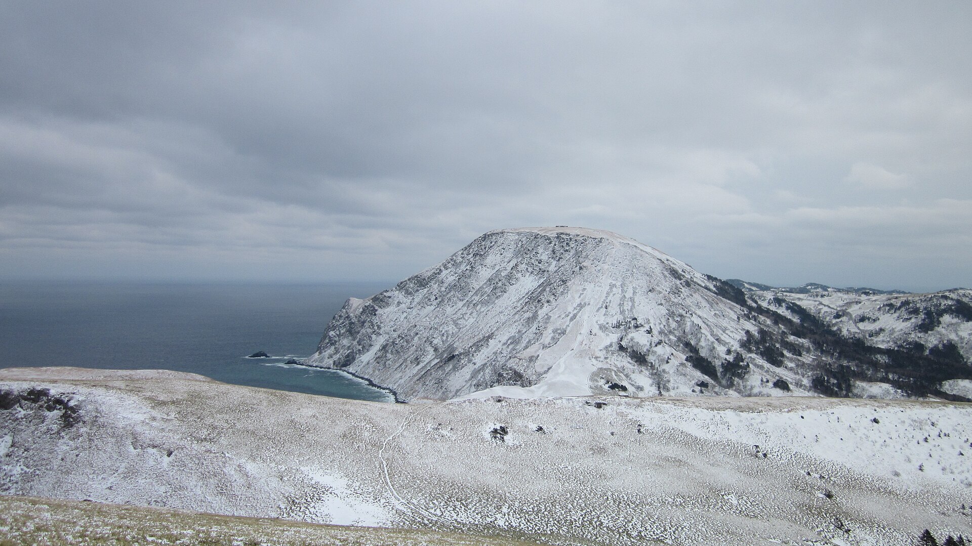
Tyatya on Kunashir rises to 1,819 meters and forms a perfect cone with a crater within a crater. The Japanese call it Tyatya-dake and can be seen from the coast of Hokkaido. Sarychev Peak on Matua Island is famous for its 2009 eruption: An ash plume was removed from the International Space Station., and the image was featured in volcanology textbooks. Mendeleev Volcano in the south of Kunashir attracts visitors with its fumarole fields: steam billows from fissures, sulfur crusts glow yellow, and hot springs gush nearby. Both volcanoes stand on islands inhabited by people, so volcanologists keep them under constant observation.
The Yankito lava plateau on Iturup lies right on the coast and is a jumble of bizarrely shaped solidified magma flows. Volcanic activity is equally visible on neighboring islands: Ebeko over Severo-Kurilsk regularly spews ash, and the Golovnin caldera on Kunashir contains two acidic lakes with steaming solfataras along their shores.
The islands' topography is young and rugged. Cones rise directly from the coast, with calderas and lakes between them, and the coastline is indented with bays. The beaches are black with volcanic sand in places, and in others, littered with driftwood washed in from the mainland. Freshwater streams flow down from the volcanoes in short channels, and their water is cold even in August.
CAREFULLY. The region remains seismically active. The famous Shikotan earthquake on October 4, 1994, reached a magnitude of 8.2 and triggered a devastating tsunami. Before your trip, check the evacuation plan in your local community and be sure to refresh your memory on earthquake safety precautions.
The climate is shaped by the cold Oyashio Current. Fog obscures the coast for weeks, humidity remains high, and precipitation is frequent. Summer temperatures reach 12°C to 18°C, and it's never too hot even in July.
A unique biological world
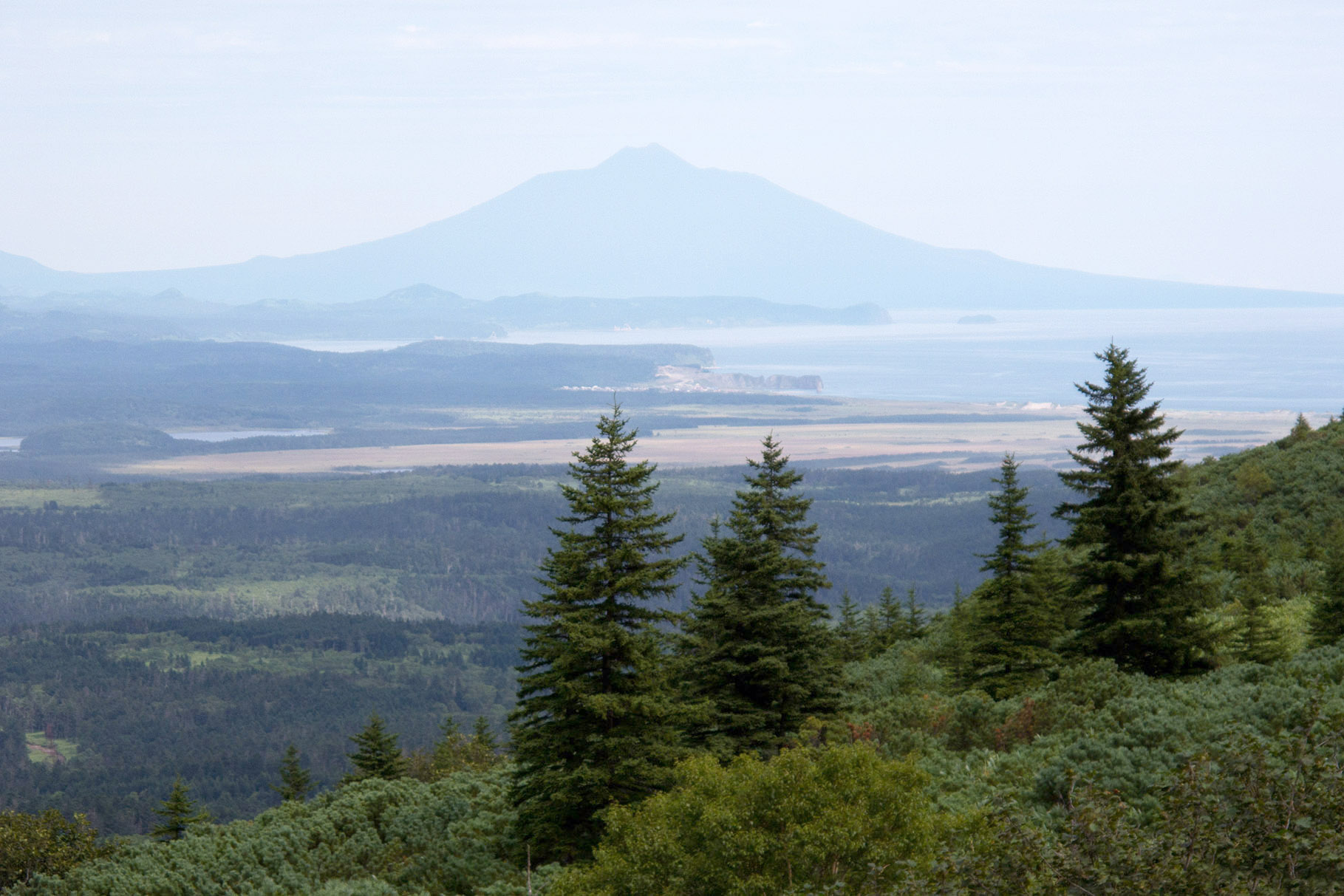
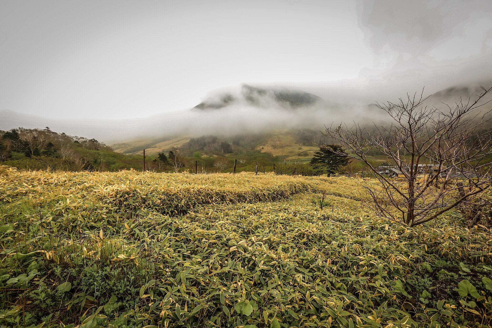
The Kuril Ridge lies at the junction of the boreal and temperate zones, so the flora and fauna are intermingled. Coniferous forests give way to thickets of bamboo, and Sakhalin knotweed grows up to four meters tall, obscuring the trail above.
Brown bears of the Ursus arctos yesoensis subspecies inhabit Iturup and Kunashir, where the population density is among the highest in the country. The animals migrate to spawning rivers and the coast, so solitary wanderings through the thickets are out of the question. Steller sea lions occupy rocky outcrops and roar loudly enough to be heard a kilometer away. Sea otters inhabit underwater kelp forests. Killer whales pass along the islands, and tufted puffins and horned puffins nest in the bird colonies. On the uninhabited islands in the central part of the archipelago, the animals are more relaxed, as they rarely encounter humans.
The Kuril Islands' natural beauty has been preserved in its pristine state for a simple reason: there are few people, almost no roads, and access is restricted by a permit system. The Kuril Nature Reserve on Kunashir and the sanctuary on the Lesser Kuril Ridge close off parts of their territory to the public, and access is only possible with permission from the administration.
Marine riches
Oyashio carries cold water from the Bering Sea., rich in nutrients, and increases the productivity of coastal waters. The fishery relies on snow crab, sea urchin, five species of Pacific salmon, pollock, and sea cucumber.
Kuril sea urchin is prized in Japanese cuisine under the name "uni" and finds its way onto Tokyo shelves as an expensive delicacy. The same product is served in ordinary cafeterias in Yuzhno-Kurilsk, only it's much cheaper there. Fish processing plants on the islands operate year-round and remain a major employer: approximately twenty thousand people live on the Kuril Islands, a significant portion of whom are employed in fishing or processing.
The History of the Kuril Islands and the Territorial Dispute: A Brief Overview
Two empires approached the Kuril Islands from opposite ends: Russia descended from Kamchatka, Japan ascended from Hokkaido. Between them lived the Ainu, who were pushed back by both sides.
From the Ainu to the 19th-century treaties
The Ainu inhabited the islands of the chain long before the arrival of Russian and Japanese expeditions. Their language has no established relationship with other languages; their economy relied on fishing and hunting; men wore full beards; women tattooed their mouths. The bear festival of Iyomante occupied a central place in their ritual life. Japan recognized the Ainu as an indigenous people through a 2008 resolution and passed a law in April 2019..
By the early 20th century, almost no Ainu remained on the Kuril Islands. The Japanese administration resettled the Kuril group to Shikotan, where the community did not survive the changing lifestyle and epidemics. However, the toponymy retained its Ainu roots: the names Iturup, Kunashir, Paramushir, and Shikotan came from their language.
The first Russian expedition to the Kuril Islands was launched by Vladimir Atlasov in 1697. Treaties followed. The Treaty of Shimoda in 1855 delineated the border between Iturup and Urup: the southern islands went to Japan, while the northern islands remained Russian. The Treaty of St. Petersburg in 1875 changed the situation entirely: Japan received all the islands, and Russia received Sakhalin.
World War II and the post-war order
The Yalta Conference was held from February 4 to 11, 1945.Roosevelt, Churchill, and Stalin agreed to transfer the Kuril Islands to the Soviet Union, although the agreement did not specify the islands. This ambiguity gave rise to the later dispute.
Soviet troops occupied the southern part of the ridge in late August and early September 1945. Japan signed the instrument of surrender on September 2, and the chronology of events around that date remains a key point in Japan's legal argument. The 1951 San Francisco Peace Treaty formalized Japan's renunciation of the Kuril Islands but did not specify the recipient. The USSR did not sign the treaty.
The 1956 Soviet-Japanese Declaration stipulated the transfer of Shikotan and Habomai after the conclusion of a peace treaty. The parties have yet to conclude a peace treaty. The post-war years brought settlers from various regions of the Soviet Union, fish processing plants, and military garrisons to the islands. The Japanese population was evacuated by 1949, and new settlements arose in their place, some of which were later washed away by a tsunami and rebuilt on higher terraces.
| Year | Document | Territorial total |
|---|---|---|
| 1855 | Shimoda Treaty | The border between Iturup and Urup: southern Japan, northern Russia |
| 1875 | Treaty of St. Petersburg | All the islands of Japan, Sakhalin of Russia |
| 1945 | Yalta Agreement | Agreement on the transfer of the Kuril Islands to the Soviet Union without a list of islands |
| 1951 | Treaty of San Francisco | Japan's renunciation of the Kuril Islands without specifying the recipient, the USSR did not sign |
| 1956 | Soviet-Japanese Declaration | Shikotan and Habomai Islands of Japan after the peace treaty, not implemented |
Modern debate: the essence of positions
The subject of controversy remain Iturup, Kunashir, Shikotan, and the Habomai Islands, covering a total area of 5,042.8 square kilometers. Japan maintains that these territories were not part of the Kuril Islands, which it renounced in 1951, as the Treaty of Shimoda assigned them to Japan prior to any subsequent agreements. Russia bases its sovereignty on the results of World War II and the established post-war international legal order.
Even the names differ: in Russia they call them the "Southern Kuril Islands," while in Japan they call them the "Northern Territories." Shinzo Abe and Vladimir Putin met dozens of times between 2012 and 2020, discussing joint economic activities and the prospect of a peace treaty. Amendments to the Constitution of Russia Article 67 enshrined a ban on actions to alienate territory.
How to visit the Kuril Islands: attractions, logistics, and practicalities
Preparations for a Kuril Island voyage begin several months in advance. The logistics are rigorous: tickets, border passes, rooms in the island's only hotels, and mandatory backup days for bad weather are all tied together in a single chain, where failure at any one point ruins the entire program. That's why travelers to the remote islands almost always travel with a tour operator: they maintain contact with border control, carriers, and hotels and reschedule the route when the weather changes.
Pass and transport
The archipelago is located in a border zone. Free entry is permitted within the district centers (Kurilsk, Yuzhno-Kurilsk, and Severo-Kurilsk), but travel beyond these limits requires a permit. It is beyond these cities that all the attractions lie: volcanoes, capes, springs, and rookeries.
The registration procedure for Russian citizens is as follows:
- Determine the route and list of objects outside the regional centers.
- Collect passport information for all trip participants, and for children, information from their birth certificates.
- Submit your application through the Gosuslugi portal or directly to the Border Directorate of the FSB of Russia for the Sakhalin Region.
- Specify the purpose of your trip, the dates and points of your route: the pass is valid within the stated boundaries.
- Track the status of your application and check the processing time in advance.
- Obtain your pass in Yuzhno-Sakhalinsk before departure to the islands.
- Take your document with you: patrols check it when leaving populated areas.
The process takes longer for foreign citizens, and it's almost always handled by the tour operator. Processing times vary, so check before applying. Permits are issued for specific islands and dates; it's not possible to change your itinerary on the spot.
There's only one transport hub: Yuzhno-Sakhalinsk. A flight from Moscow takes about nine hours, from Vladivostok just over an hour. From there, Aurora Airlines takes over: flights depart for two islands, Iturup and Kunashir, with a travel time of just over an hour and several flights per week. Yasny Airport on Iturup was commissioned in 2014.Mendeleyevo Airport operates on Kunashir. A boat departs from the port of Korsakov; the journey takes about 18 hours, and the seas can be severe.
IMPORTANT. Fog closes airports for a day or more, and flights are rescheduled without notice. Allow two or three extra days for your return journey and purchase exchangeable tickets. Check the Aurora schedule and ferry service immediately before your trip.
Attractions on the islands
August and September are the best seasons to visit the Kuril Islands: the fog thins out, and temperatures hover around 12°C to 18°C. September brings autumn colors, mushrooms, and salmon runs in the rivers. July remains the foggiest month, October is drenched with rain, and from November to April, transportation is inconsistent. The route around the islands usually progresses from easy to difficult: first Kunashir with short excursions, then Iturup with its distant points.
Iturup is the largest island in the chain. Here's what's worth seeing:
- The White Cliffs are cliffs of pumice and volcanic glass that stretch along the coast for several kilometers;
- thermal springs of the Baransky volcano with hot streams and cauldrons;
- Yanquito lava plateau - black and reddish rocks of solidified lava on the very seashore;
- Kasatka Bay with black volcanic sand.
Kunashir lies furthest south of all the islands and is closest to Japan. Key points:
- Mount Tyatya is 1819 meters high, climbing it takes a full day and requires preparation;
- fumarole fields and hot springs of the Mendeleev volcano, accessible in a couple of hours' walk;
- Cape Stolbchaty with basalt columns arranged in a semblance of stonework;
- Kurilsky Nature Reserve with a relict forest of magnolia and yew.
Shikotan is smaller than its neighbors and has no volcanoes: the island is composed of ancient rocks, with a gentle, hilly topography. Cape Kray Sveta (Cape Edge of the World) drops into the ocean with a nearly hundred-meter-high cliff, and its name stuck long before the tourism boom. Otradnaya Bay shelters fishing boats from the wind, and tall grass as tall as a man grows on the slopes above in summer. The island is reached by boat from Yuzhno-Kurilsk or Korsakov; there is no airport.
Practical tips for tourists
The three towns and villages on the islands follow their own schedules. Kurilsk on Iturup stands in Whale Bay, Yuzhno-Kurilsk on Kunashir overlooks the Pacific Ocean, and Severo-Kurilsk on Paramushir is nestled at the foot of Mount Ebeko. Shops close early, cafes stay open until evening, and taxis are ordered by phone because apps haven't caught on on the islands.
Accommodation on the islands is limited to a few hotels and guesthouses in the district centers. These are booked up months in advance, so book in advance and check availability on your desired dates. Island tours include accommodation, and for a first trip, this option takes half the hassle out of the trip.
The gastronomy makes up for the inconveniences. Sea urchin, crab, and salmon are served the same day they're caught, and caviar is sold right at the port. Mobile phone service is available through MegaFon and MTS in the villages, but outside the villages, the signal drops: load your maps in Yuzhno-Sakhalinsk. Bring plenty of cash; payment terminals are rare.
Traveling between islands during a trip requires special planning. Direct flights between Iturup and Kunashir are rare; the route usually goes via Yuzhno-Sakhalinsk, and each flight adds a day. The ship sails around the islands according to a schedule that fluctuates with the weather. A minimum of ten days is planned for a trip to two or three islands.
ADVICE. Bears come to the rivers during the salmon run, and on Kunashir and Iturup, they can be found right near villages. Go on the trail with a guide, carry a flare or spray, and talk along the trail. In fumarole areas, follow only marked trails, as hydrogen sulfide accumulates in the lowlands.
Ready-made programs for Sakhalin and the Kuril Islands
| Program | Term | Per person | What's included |
|---|---|---|---|
| Sakhalin and Iturup | from 7 days | from 365,000 ₽ | Aniva Lighthouse, Cape Velikan, a gourmet lunch at Busse Lagoon, a flight to Iturup, the thermal springs of Baransky Volcano, a jeep tour to the White Rocks and the Yankito lava plateau |
| Sakhalin - Iturup - Kunashir | from 14 days | from 595,000 ₽ | All of the above plus a boat trip between the islands, Cape Stolbchaty, an all-terrain vehicle to Golovninsky Cliff, trekking along the boiling lakes of the Golovnin volcano, and hot springs |
Prices for 2026 are per person for a group of four and include accommodations in the islands' best hotels, personal guides for all excursion days, 4x4 transfers, and seafood breakfasts and lunches along the route. Flights from Moscow and domestic flights are negotiated separately. Please check current prices and available dates before booking.
Summary: Where to start preparing
Steaming fumaroles, the roar of wild sea lions on the coastal cliffs, and the ghostly silhouette of Hokkaido on the horizon—for these Kuril Islands landscapes, travelers are willing to fly for nine hours and wait days for favorable weather. The Kuril Islands are woven from contradictions: here, the Pacific Ring of Fire changes the landscape before your very eyes, the volcanoes bear the names of the extinct Ainu language, and strict bureaucracy coexists with the absolute freedom of the wild. This archipelago generously offers otherworldly experiences, but in return, it demands immense patience.
Preparations for such a trip begin long before departure, with obtaining scarce tickets and border zone passes. If you don't want to spend months on connecting flights, corresponding with border control, and hunting for numbers, we'll do it for you. individual tour of Sakhalin and the Kuril Islands From GO&DO, we'll create a customized itinerary for your group, handle all permits, book the best hotels on the islands, and stay in touch throughout your trip—even rescheduling the itinerary if fog closes the airport.
Frequently Asked Questions
Who owns the Kuril Islands now?
The archipelago is administered by Russia and is part of the Sakhalin Oblast. Japan claims four islands: Iturup, Kunashir, Shikotan, and the Habomai group, calling them the Northern Territories. No peace treaty has been concluded between the two countries; negotiations have been ongoing since the mid-20th century.
Is it possible to get to the Kuril Islands?
Yes, travel to the Kuril Islands is open to both Russian citizens and foreigners. The restriction is due to border regulations: staying in the district centers is free, but leaving requires a permit. Travel is by plane from Yuzhno-Sakhalinsk or by boat from the port of Korsakov.
How did the Kuril Islands become Russian?
Under the Yalta Agreement of 1945, the archipelago was transferred to the Soviet Union, with troops occupying the southern portion in late August and early September of that year. The Treaty of San Francisco of 1951 formalized Japan's renunciation of the Kuril Islands without specifying a recipient; the USSR did not sign it.
What do you need to get to the Kuril Islands?
A passport, a border zone pass for travel beyond the district centers, tickets to Yuzhno-Sakhalinsk and further to the islands, and accommodation reservations. Applications for the pass can be submitted through the Gosuslugi website or directly to the FSB Border Directorate for the Sakhalin Region.
When is the best time to visit the Kuril Islands?
August and September: fog clears more frequently, temperatures hover around 12°C to 18°C, salmon runs, and mushrooms and berries ripen. July remains the foggiest month in the Kuril Islands, October is rainy, and winter transportation is irregular.
Are there bears on the Kuril Islands?
Brown bears inhabit Iturup and Kunashir, where the population density is high. The animals migrate to spawning rivers and the coast, and are found near villages. It is not recommended to venture out alone: a guide is mandatory on these islands.
Sources
- Kuril Islands // Wikipedia. ru.wikipedia.org
- Volcanoes of the Kuril Islands // Wikipedia. ru.wikipedia.org
- Rumyantsev V. Cold Kuril Current (Oyashio) // Historical Geography. geohyst.ru
- Ainu // Wikipedia. ru.wikipedia.org
- Yalta Conference // Wikipedia. ru.wikipedia.org
- The problem of ownership of the Southern Kuril Islands // Wikipedia. ru.wikipedia.org
- Constitution of the Russian Federation. Article 67 // ConsultantPlus. consultant.ru
- The project to build a new airport in the Kuril Islands has lost funding for 2014 // TASS. - May 7, 2014. tass.ru